- 1:22 h
- 5.67 km
- 3 m
- 5 m
- 76 m
- 79 m
- 3 m
- Start: Stadtmarkt 7A, 38300 Wolfenbüttel
- Destination: Landeshuter Platz, 38300 Wolfenbüttel
Today's town of Wolfenbüttel owes its name to the former moated castle of the same name. The settlement area around Wolfenbüttel Castle, the district around the residential palace that still stands today, was later named Dammfestung after a dam that had been built around the castle in the marshy area of the River Oker. This dam fortress and the various districts of the Old and New Heinrichstadt, the Auguststadt and today's Juliusstadt, which together with the dam fortress have borne the town name Wolfenbüttel since 1747, separated and flowed through artificially created arms of the Oker river. Today, with a few exceptions, these Wolfenbüttel waterways no longer exist. A signposted tour is intended to help clarify the former location and shape of the ditches and canals in the city area
Good to know
Pavements
Best to visit
Directions
Station 2: In the 16th century, the course of the River Oker between the Great and Small Palaces was spanned by a simple stone bridge in front of the main portal of the Residential Palace and a narrow pedestrian bridge. This was located around twenty meters south of the present-day palace bridge and connected the chambers and chancellery of Duke Julius with the chancellor's house, which was later converted into the court printing works. Close to this wooden pedestrian bridge, presumably in the area of the Old Pleasure Garden, there was also a landing stage for the ducal ceremonial gondolas of the 16th century, which Duke Julius used to glide to his summer residence in Hesse Palace. At that time, the Oker and Bruchgraben were navigable as far as Hesse. The Wolfenbüttel Knight's Academy - which, together with the surviving wing of the Small Palace, formed a three-winged building that once opened onto the palace square in a horseshoe shape - was one of the earliest academies in Germany, where applied architecture was taught alongside other subjects from 1687, decades before the more famous academies in Vienna and Berlin were founded.
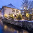
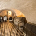
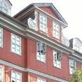
Station 3: Around 1715, the Renaissance palace of the Dukes of Brunswick and Lüneburg was given a Baroque half-timbered façade facing the Oker river, which was inspired by the style of Amsterdam's town hall. As a result, the now narrower Schlossgracht appeared less defensive than on the Merian engraving of 1654. The vaulted space under the wide arcades of the lower floor of the palace provided room for magnificent royal gondolas. On the north side, there was a direct access to the canal that still exists today: this is where the horse pond was located, where the horses were cleaned and watered.
Station 4: The connecting canal between the northern moat and the old sawmill (later Schünemann's mill) was one of the oldest waterways in the town of Wolfenbüttel.
Station 5: For centuries, an "s"-shaped branch of the Oker flowed through the embankment fortress where the main staircase of the Bibliotheca Augusta rises today; in 1884 it was diverted to the north and filled in. The current library building was built between 1881 and 1886 in the neo-Renaissance style. Its important predecessor, the baroque library rotunda built by Hermann Korb between 1706 and 1710, had to be demolished in 1887 due to dilapidation. This half-timbered building had influenced the construction of the so-called Radcliff Camera (the Baroque observatory) in Oxford, the Weimar Court Library and presumably also the Vienna Court Library. Today's Lessing House was the residence of court librarian Gotthold Ephraim Lessing from 1779 to 1781, where he wrote his famous drama "Nathan the Wise" after the death of his wife.
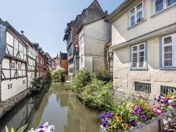
Station 6: For centuries, the watercourse popularly known as "Little Venice" was the southern approach to the busy harbor basin near the sawmill and new mill, a pulsating lifeblood of Heinrichstadt. In the 16th century, this canal provided the shortest connection to the Schlentermühle and southern Okerumflut. The confusing, evolved layout of this inland port has been precisely preserved for the middle of the 19th century. According to a colored ground plan from this time, there was a landing stage parallel between the two mills, which was accessible from the dam ditch and the northern outflow of the Oker. At that time, two small connecting canals were already arched over, which led to the Dammgraben and the northern fortress ditch. On its northern bank, in the area of today's "Rosenwinkel", was traditionally the laundry pond. Today's Schünemannsche Mühle, guest house and multi-purpose hall of the "Bundesakademie für kulturelle Bildung" (Federal Academy for Cultural Education), was only built during the Gründerzeit (1890s); around 1850, the "Neue Mühle" still stood on its site with its own yard, which was also used as a fortress kennel, as a covered wooden bridge was built from this yard to the north over the fortress moat; the old sawmill stood a little further north. There were also several smaller sawmills in Wolfenbüttel. From the western outer perimeter of Schünemann's mill, you can clearly see the surviving side flank of the New Finkenberg bastion made of travertine ashlars (completed around 1590).
Station 7: A bridge covered with cobblestones was present at the beginning of the connecting path from the north gate to the main church (approx. 100 meters away) by 1723 at the latest. A stone-built successor with wide-span basket arches was erected in 1737. This bridge was still in existence around 1900; it was probably demolished around 1910. Between the bridge and the sawmills to the west, there were several tanneries and dye works along the Bruchgraben, which were always found on the outskirts of the towns due to the foul smell. Until around 1550, the Old Gate was the most important entrance to the then still village-like settlement in front of Wolfenbüttel Castle. However, it was demolished in the 17th century.
Station 8: In the time of Duke Henry the Younger (r. 1514-1568), this was the furthest north-western section of Wolfenbüttel. As the woodcut by Lucas Cranach the Elder from 1542 shows, it was protected by a round bastion made of earth and bundles of rods. On the far bank of the Okerum floodplain stood a collection of birdhouses, at which bird shooting was probably organized from the bastion as a popular amusement. In the 1570s, this outdated fortification was replaced by a stone curtain wall, which led to the newly built "Philippsberg". Parts of the Okerstraße canal were probably only filled in in the 1920s. All bridges and canal walls date back to the 18th century. An avenue of mulberry trees is said to have once accompanied the waterway.
Station 9: Unlike the town hall, the brewer's guild house, which was built around 1600, was filled with bricks at a later date. The Oker flowed along the front of the building as an approximately four-meter-wide canal. The bridge south of the brewers' guildhall was one of the most important in the city: it connected the new Heinrichstadt with the old Heinrichstadt, the Holzmarkt with the Kornmarkt. Around 1720, it was covered with cobblestones and had a right-angled extension in the middle, just like the Dammtor Bridge. There was already a western city gate here in the 15th century, which was extended as an inner-city fortification with stone arches under Duke Julius in 1581.
Station 10: During the reign of the last Catholic Duke Henry the Younger (1514 - 1568), Fischerstraße, which crosses Harzstraße at this point, was the eastern moat of the settlement in front of the embankment fortress, which was still called Liebfrauenstadt at the time. The stone bridge, which before the First World War led the Harzstraße over a city canal, the Bruch- or Lange Graben, was only about three meters wide and arched over a swing arch in the Amsterdam style. A wooden bridge made of cross planks still stood here in 1723. The flanking walls of the baroque canal from around 1750 still run underneath Fischerstraße. Beyond this to the east was the poor people's quarter - demolished in the 1930s and 1970s, with a foul-smelling tannery basin on the southern edge. Despite the lack of an eastern end, Harzstraße was the most elegant street in Wolfenbüttel alongside Kanzleistraße until well into the 19th century. The former "von Dehnsche Haus" stood at the western end, with the Samson School and synagogue of the Jewish community in the middle.
Station 11: Located around twenty meters south of Harztorplatz, the Harztor (built in 1603, demolished in 1834) was Wolfenbüttel's main entrance after the Kaisertor in the west of the city. At the time of Duke Julius (r. 1568 - 1589), this entrance was little more than a narrow footbridge used mainly by farmers from the southern villages. At least two drawbridges had to be crossed outside the bastion belt on the field side of the gate. The steel construction on the inner-city Oker Bridge is a reminder of this. The post-modern sculpture on today's Harztorplatz is modeled on a former bascule bridge near Klein-Stöckheim.
Station 12: The Kommisse was initially designed as an office and department store around 1580, but was eventually built as a new mill with integrated stalls between 1587 and 1588. The elongated office building for the citizens of Heinrichstadt was built by the versatile architect Paul Francke, who had to keep an eye on the vast quantities of provisions in the 61 by 14 meter long building. Duke Julius hoped that this would enable him to determine the food prices in the region, but this proved to be unrealistic due to the strong competition from Braunschweig. The building was originally surrounded by two canals to the west and east, so that barges could also go alongside on the western side. The canal at the rear and a branch canal to the moat at the Großer Zimmerhof were gradually filled in between 1700 and 1740. The stone bridge that today leads to the western long side is inscribed with the date 1751. A stone bridge had already been built here instead of a wooden one in 1714 when Duke August Wilhelm, who also had the castle bridge rebuilt, took office. There was a tavern on the first floor of the commissary and a large dance hall for civic celebrations on the second floor. There was also accommodation for guests in the building. From 1705, the Great School was temporarily housed here.
Station 13: To the south of the Heinrichstädter Apotheke, one of Wolfenbüttel's oldest half-timbered houses, was the widest of the three stone bridges that connected the half-timbered buildings on Reichsstraße with the Kornmarkt across a navigable canal in 1723. The canal - later called the Muddegraben because of its pollution - flowed from the north-east corner of the Kommisse to the brewers' guildhall, past the southern end of which it ran. In the 18th century, the southern flank of the canal was home to the "Fleisch-Scharrn", single-storey butchers' and country butchers' stalls. The canal with its enclosing walls dating from around 1750 was only navigable in the 16th and early 17th centuries. A painting from 1867 shows it already filled in. The avenue of lime trees planted earlier has been preserved to this day thanks to the efforts of a citizens' initiative. From the 18th century onwards, all bridges followed the same design with two arcades. In the 16th century, there were probably only retractable wooden footbridges and bridges that made the canals navigable. The situation in the 16th century must have been similar for the other three bridges to ensure navigability.
Station 14: The "reconstruction plan" of the Wolfenbüttel fortress (around 1650) shows that the Oker Canal crossing here behind two rows of houses was much narrower than the one on the Reichsstraße. Both canals, as well as a third one north of Stobenstraße, the so-called Bruchgraben, ran parallel to each other. The Kanzleistraßen canal - also popularly known as the Rotten Ditch - was filled in between 1730 and 1796 due to its terrible smell - the same fate befell the Bruchgraben around 1900 and also, before 1867, the main canal on Reichsstraße. Wooden bridges at the Old Gate and in Bärengasse were already present in the 16th century and originally aligned with each other, but from around 1575 the massive building of the ducal chancellery (as well as the factories in the rear courtyard) was pushed into this alignment, so that the traditional passageway to the old market square at the main church BMV was now blocked. This was not only for representative reasons, but also for political and economic reasons. The ensemble, including the buried canal, is therefore a significant testimony to the rise of mercantilism
Station 15: Hardly any visitor who walks from Lange Herzogstraße through the street "An den Krambuden" today notices that the initially narrow section of the street, which later widens considerably, is a bridge over the "Grand Canal", similar to Erfurt's Krämerbrücke or the Florentine Ponte Vecchio (the water of the "Grand Canal" is visible under the gully cover near the stand sign). Until its demolition around 1700, the Lauen or Lion Gate stood at the narrowest point of the street, which together with the embankment moat and the embankment gate secured access to the embankment fortress. Before 1600, there was initially a wooden bridge with merchants' stalls at the sides, which was converted into a stone bridge with stalls in 1604. The current development with the houses with arcades on the south side was built in the late 17th and 18th centuries. Between 1897 and 1954, the "electric" streetcar (from Braunschweig to Wolfenbüttel) ran along Krambuden-Straße alongside other traffic.
Station 16: The moat running from north to south between the old Heinrichstadt and the Dammfeste (today's castle area) was more than twice as wide as all other moats within the bastion belt, averaging 70 meters. The moat separated the sovereign area - the Dammfeste - from the bourgeois residential areas - the Freiheit and the old Heinrichstadt. As early as the 16th century, an inclined stone bridge led from the Freiheit to the spacious forecourt of the Dammfeste. The bridge had lateral extensions in the middle, which were the sites for two statues. At the end of the bridge, the rearmost part of which was secured by a drawbridge, stood the Dammtor, which was built in the second half of the 15th century and demolished in 1804.
Station 17: The Grand Canal running behind the town hall was several meters wider in the 16th century, while the adjacent half-timbered houses were narrower and lower than they are today. Around 1700, oak piles were driven in to support the morbid sheet pile walls, which led in a "v" shape to three parallel barrel vaults under the Krambuden. In the early 18th century, the space between the stone sheet pile wall and the oak piles was filled in to create storage space and (on the west bank) garden land.
Station 18: The moat at Grossen Zimmerhof, which is still preserved today, was part of the area known as the Freiheit (between the dam fortress and Alter Heinrichstadt). Today's lock house with weir from 1858 is located on the site of the older main lock. This served to regulate the relationship between the water masses of the Oker arm entering here in Dammfeste and Heinrichstadt. While the water from the eastern part of the ditch fed the "Große Kanal", the Schleusen- or Kommissgraben and the Langen- or Bruchgraben, the western part originally led to the Dammgraben. The ditch, which was wider until the 18th century, served as a landing point for timber rafts from the Harz Mountains. The timber was processed by carpenters in the area between the ditch and the embankment (at the location of today's road south above the ditch) and in the area of today's Zimmerhofstraße, which led to the name of the road.
Station 19: After the Thirty Years' War, between 1651 and 1665, under Duke Augustus the Younger, the fortifications of the embankment fortress and Heinrichstadt were strengthened by the fortress engineer Cornelius von dem Busch by filling in earth in front of the ramparts. When the main gate, the Kaisertor, was damaged by a lightning strike, it was decided to build a new city gate, the Herzogtor, on the specially secured north side around 1660. On the field side of the gate, a standing figure and an equestrian figure of Duke August (accompanied by two guards with spears) stood in round arched openings. The wooden figures including the princely coat of arms from the town side of the gate, which were preserved after the gate was demolished in 1820, are now in the Braunschweig State Museum. After filling in the moat and leveling the ramparts, a traffic circle was created in 1824/25 and two neoclassical guardhouses in front of the demolished ducal gate in 1825.
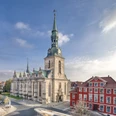
Station 20: Two round-arched passages for pedestrians have been preserved in the sacristy of the Trinity Church, which were built around 1590 into the magnificent city gate in the west of Heinrichstadt, the so-called "Kaisertor", which stood here for almost a century. The imposing city gate, which was the main entrance from Brunswick until the Duke's Gate was built around 1660, was designed by the Dutch architect, engineer, painter and designer Hans Vredemann de Vries. It is likely that a previous building, which had already housed the courtroom for the ducal court in 1571, was included in its construction. Master builder Johann Balthasar Lauterbach took over the lower parts of this gate for the choir area when building the Trinitatis Church in 1693, but destroyed everything else. Except for a few privileged members of the court, everyone had to enter Heinrichstadt or Juliusfriedenstadt through the Kaisertor during the 16th century. A wooden footbridge about thirty meters long, which was soon replaced by several stone arches and two bascule bridges, led to the gate from the east. At the wedding of Elisabeth of Denmark to Duke Heinrich Julius (1590), two miniature warships filled with sawdust were blown up simultaneously on the wide moat to the side of this bridge in front of the towering view of the gate, town and residential palace after firing 16,000 shots. This was accompanied by a truly royal firework display. This was the most elaborate celebration Wolfenbüttel has ever seen.
Author
Jessica Lau
Organization
Nördliches Harzvorland Tourismusverband e.V.
License (master data)
Social Media
Nearby
